
The following maps, videos and graphics provide context for escalating tensions between Iran and the United States in 2019.
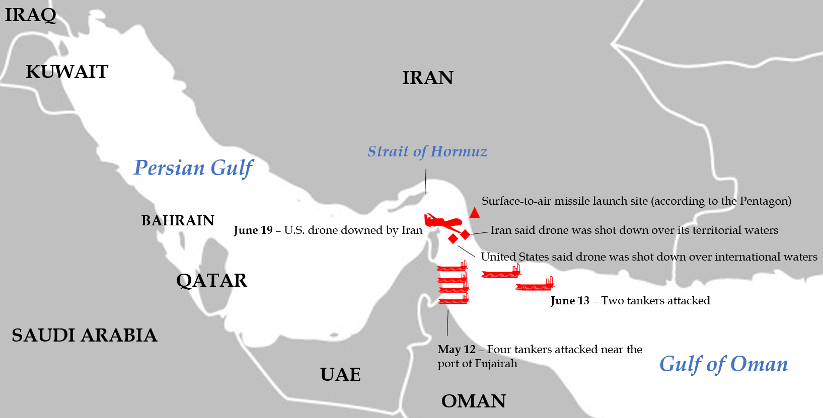
Map of May-June 2019 Incidents
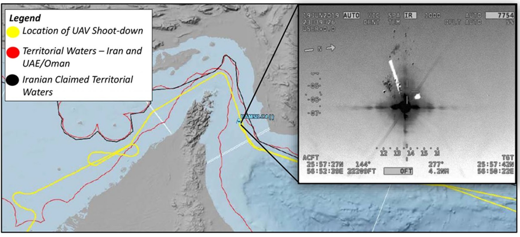
Department of Defense Map of U.S. Drone Flight Path
Active Duty U.S. Troops
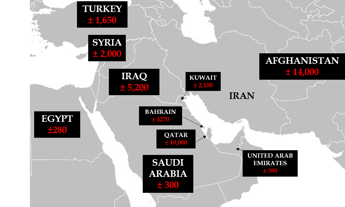
Sources: Defense Manpower Data Center for countries with 100+ troops as of March 31, 2019 via CNN (rounded); Afghanistan estimate by The Associated Press (June 2019); Syria estimate (March 2019) by The New York Times
RQ-4 Global Hawk
The type of drone that Iran downed on June 19 was a Global Hawk. The unmanned aerial vehicle (UAV) "provides real-time intelligence, surveillance and reconnaissance missions (ISR) over vast ocean and coastal regions,” according to CENTCOM spokesperson Navy Captain Bill Urban. Produced by Northrop Grumman, it first entered service with the U.S. Air Force in 2001.
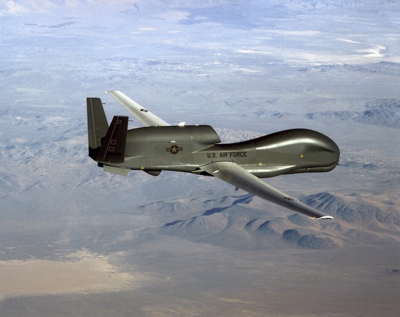
Properties of the drone include:
• Unarmed
• Land-based
• 310 knots/357 miles per hour speed
• 60,000 feet max altitude
• 131-foot wingspan
• 32+ hours of flight without refueling
• 12,300 nautical mile operational range
• All-weather radar and infrared camera for night surveillance
• Satellite and line-of-sight communications
• Last publicly reported unit cost was $223 million in August 2012
• A similar drone, the MQ-4C Triton, had a unit cost of $225 million in October 2018